memories for a lifetime
Snowman Trek
Overview
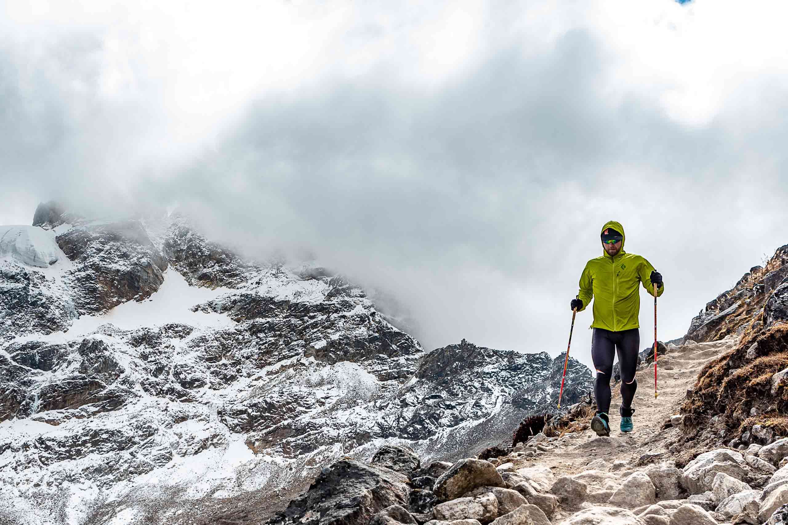
The Snowman Trek in Bhutan is one of the most beautiful treks in the entire Himalayas. In fact, it’s billed as the most difficult trek in the world due to altitude, duration, and distance—surprisingly, far more people climb Mount Everest in Nepal than complete this alpine quest.
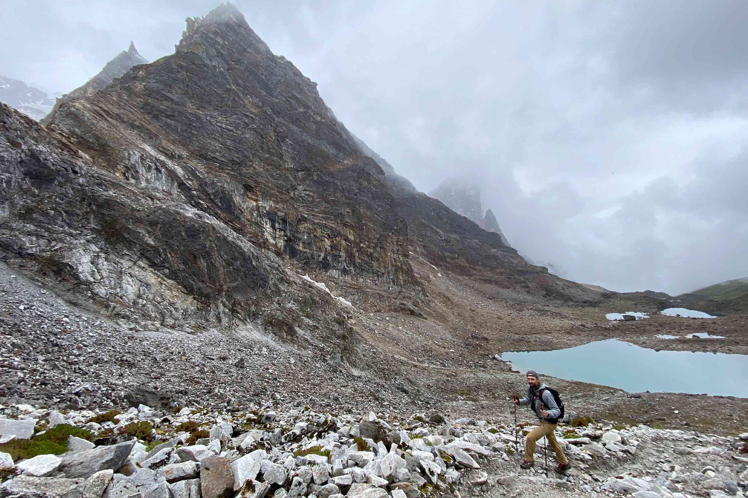
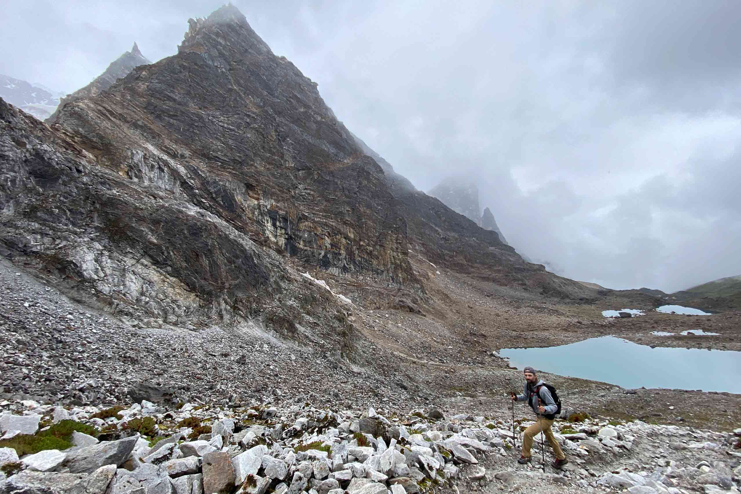
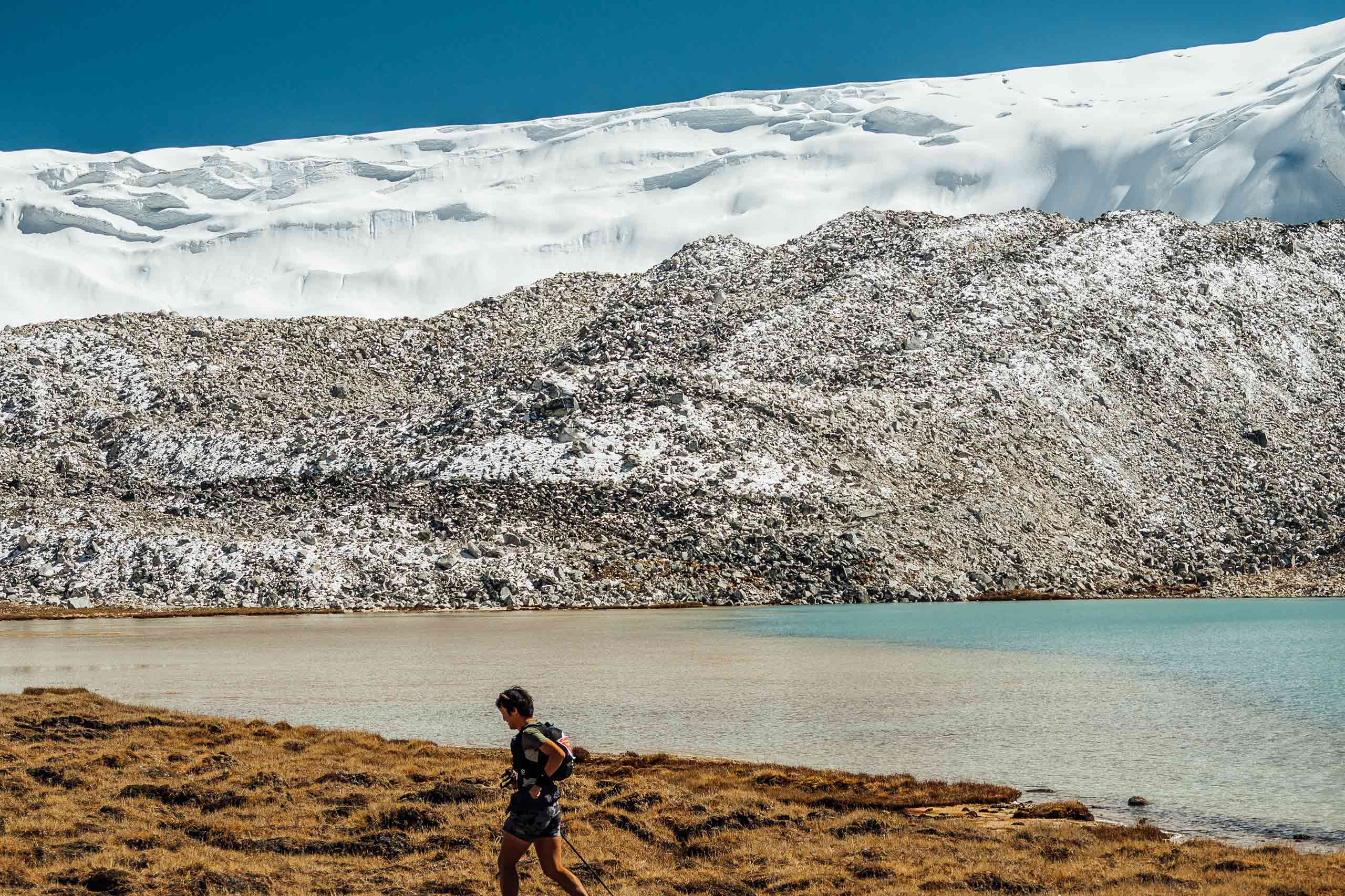
Throughout this journey, the challenging route travels along northern Bhutan’s border with Tibet, crossing thirteen Himalayan mountain passes, some as high as 5,000m. Along the way, you’ll enjoy spectacular views of Mt. Jumolhari, Jichu Drake, Masangang, Tiger Mountain, and Gangkar Puensum, as well as other impressive peaks dotting the northern border.
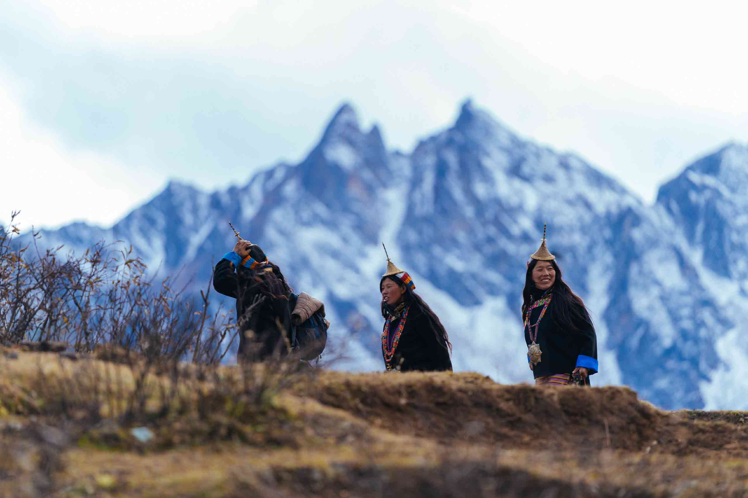
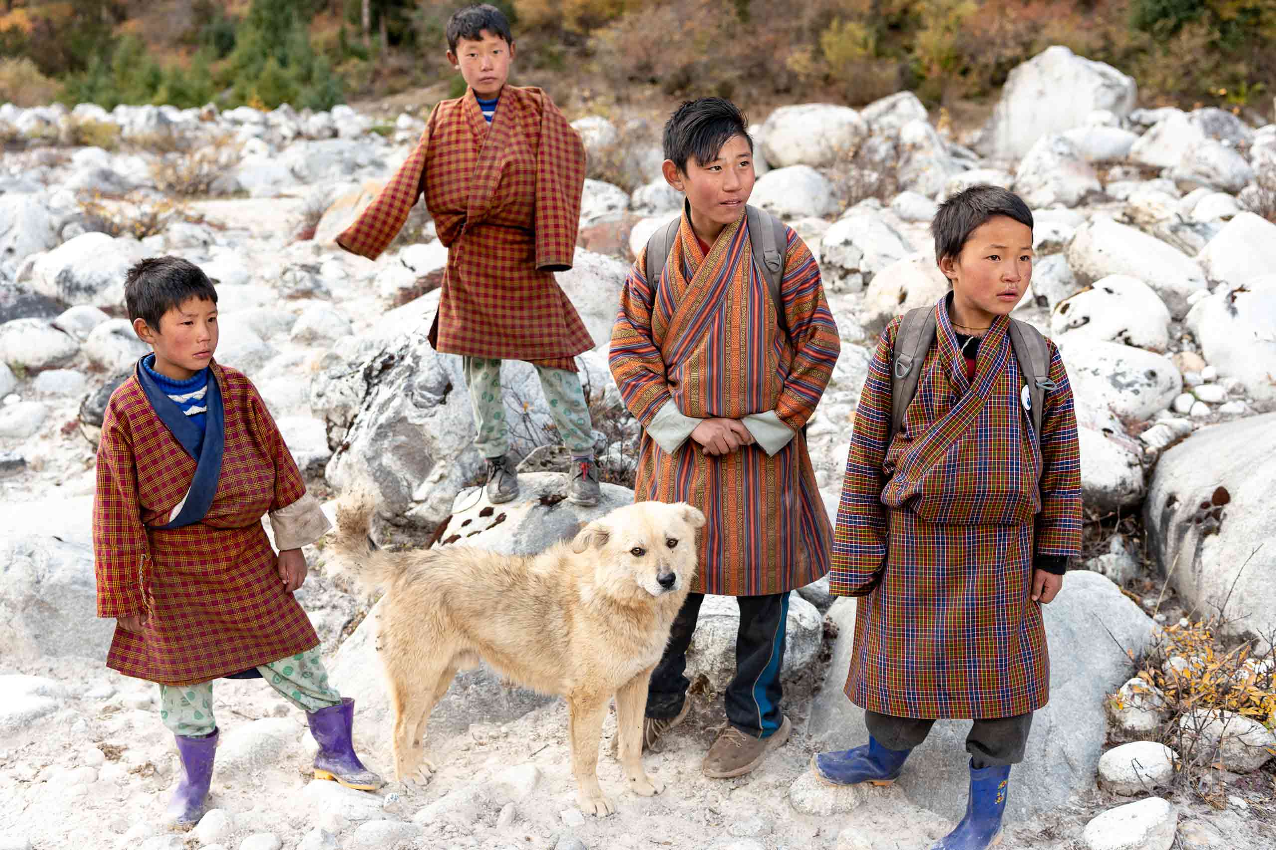
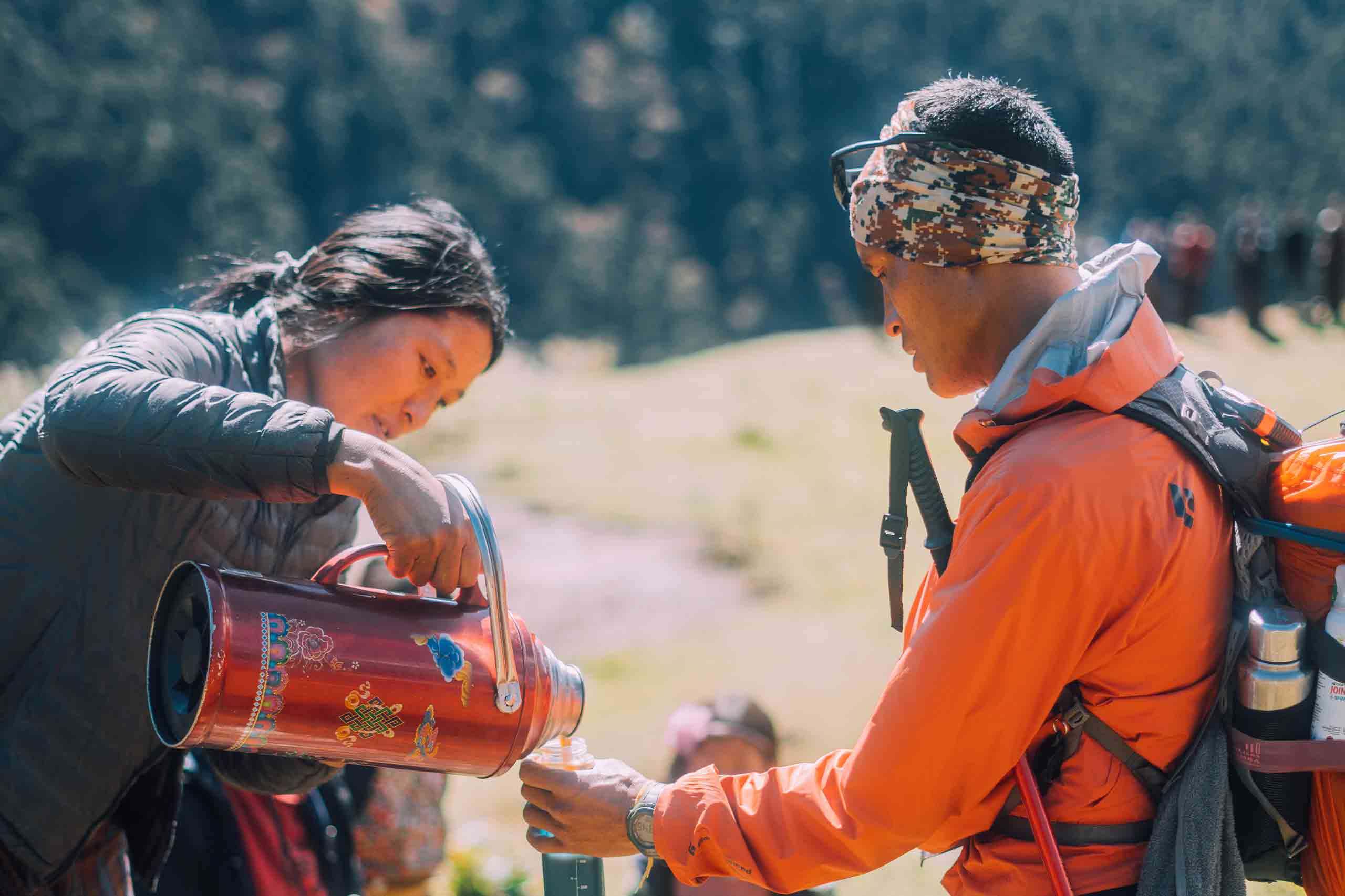
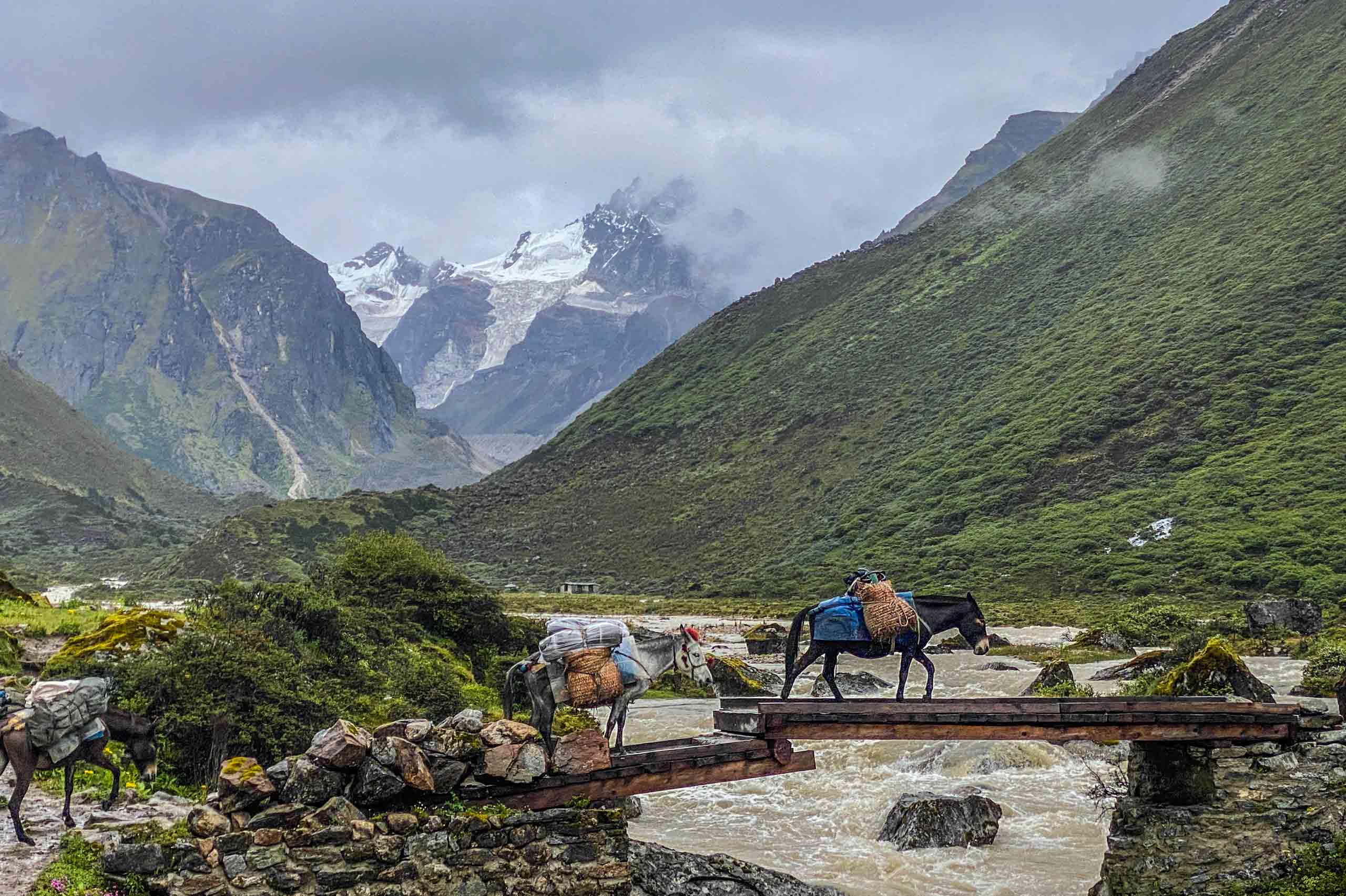
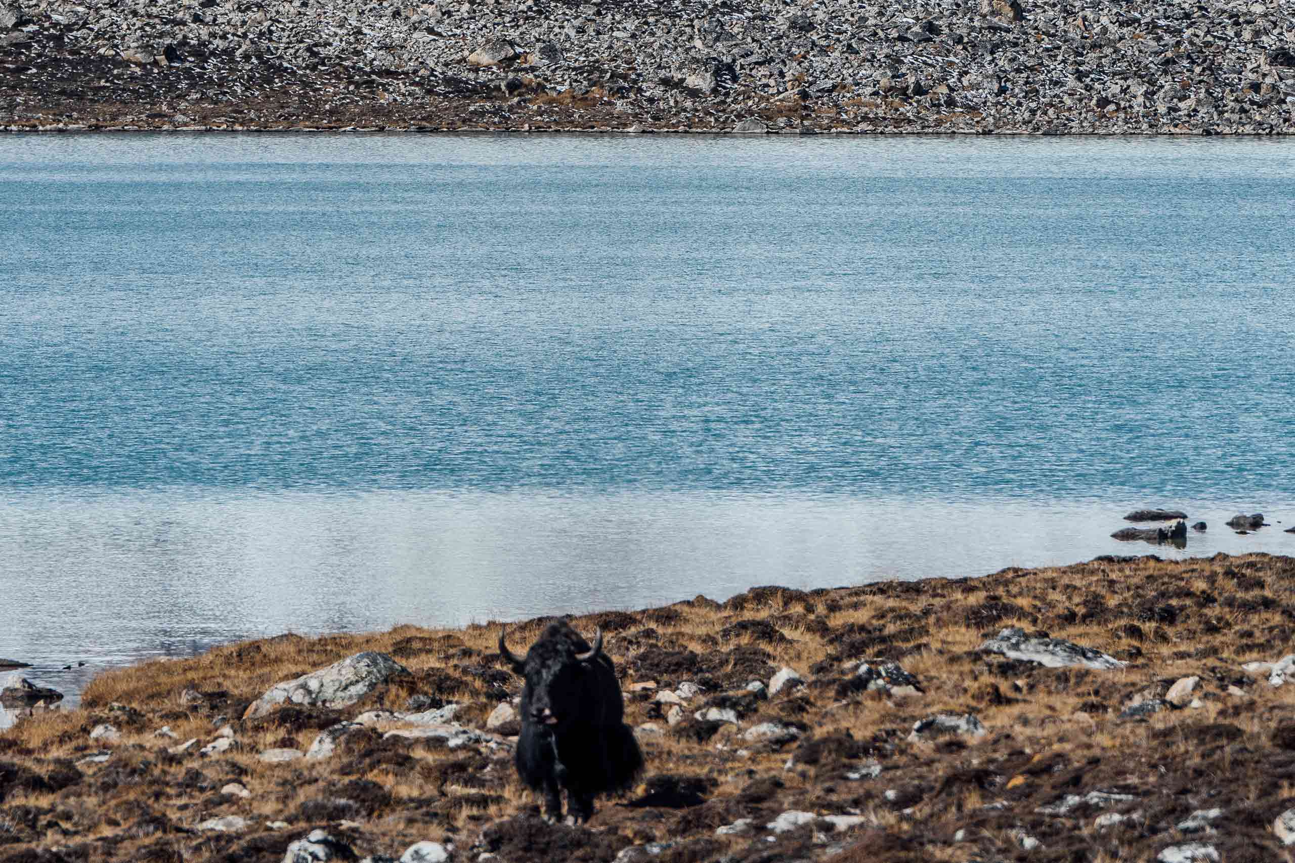
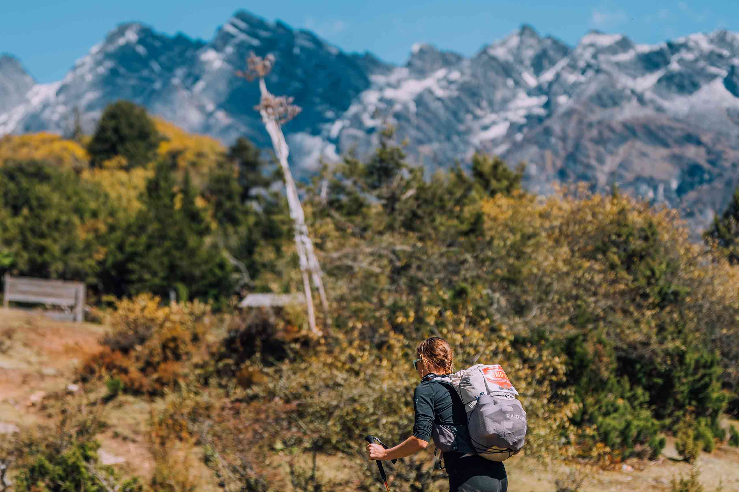
Moreover, this trek offers unparalleled opportunities to experience remote Himalayan culture. Additionally, you’ll encounter pristine mountain lakes, imposing glaciers, and rare wildlife in their natural habitat.
28 Days | 27 Nights
Duration
28 Days
Group Size
2 & above
Trek grade
Hard
Accommodation
Camp/ Hotels
Best season
Sep-Oct
Avg. Walking Dist.
18 Km
Avg. Walking Time
7 Hours
Highest altitude
5250 M
Tour highlights
- The most challenging trek in the world takes you above 5,000 meters.
- Cross 11 high mountain passes and several rivers
- Views of – Mount Jomolhari, Jichu Drake and Gangkar Museum.
- Views of – Mount Jomolhari, Jichu Drake and Gangkar Museum.
- Visit some of Bhutan's highest villages.
- Walk through Natural habitats of Blue Sheep, snow leopard, etc.
- Hike to Tiger's Nest Monastery prior to your trek.
Tour Itinerary
Day 1: Arrive Paro, 2250m
The flight to Paro crosses the Himalayan Mountains, offering great views of the impressive peaks, including the sacred Jumolhari and Jichu Drake in Bhutan. Upon arrival at Paro Airport, you will be received by our guide and transferred to a restaurant for lunch.
After lunch, you will visit the Rinpung Dzong, the 15th-century massive fortress which now serves as the administrative and monastic center of the valley. From the Dzong, you can walk down to the road head, crossing a traditional wooden bridge. Following this, you will be taken to Kichu Lhakhang, one of the oldest and most sacred temples built in the 7th century. In the evening, you can stroll in Paro town.
Day 2: Acclimatization hike to Tiger’s Nest Monastery
5Km | 4-5 hours | 900m Ascent
After breakfast, you will hike to Taktsang (Tiger’s Nest) Monastery, Bhutan’s most famous monastery, which is located at the face of the cliff (3100m) offering the best view of Paro valley. Today’s hike will be the acclimatization for the next day’s trek. According to legend, it is believed that Guru Rimpoche, the 8th-century Spiritual Master, flew to this location on the back of a tigress to meditate. Lunch will be served at Cafeteria Restaurant halfway up the mountain. Explore the monastery and hike back to Paro. Overnight in hotel.
Day 3 : Drugyal Dzong to Shana (Trek starts)
17Km | 4-5 hours | 450 Ascent | 70 Descent Camp | altitude 2850m
First, drive 30 minutes north of Paro, where the trek starts from Drugyal Dzong at 2400m with a downhill walk on a wide trail. The trail gradually ascends through Chentoe village of rice terraces, fields of millet, and apple orchards. After about four hours of walking, you will reach the army post at Gunitsawa (2,800m). At the army checkpoint, your trek permit (provided by your tour operator) will be checked and approved. Then, walk for another 20 minutes to reach our campsite. The campsite is on the opposite side of the Paro river.
Day 4: Shana to Sio Thangthangkha
21Km | 6-7 hours | 900 Ascent | Camp altitude 3750m
Today will be a long day of trekking, following the Paro river and crossing several wooden bridges. After that, the trail enters the National Park after crossing the wooden bridge, and then continues with lots of small ups and downs in the forest of rhododendrons, fir, hemlock, larch, spruce, and birch. Finally, after crossing the last bridge for the day, climb uphill gradually through the meadow where a camp will be set up at the altitude of 3750m. From here, if weather permits, you will see an amazing view of Mt. Jumolhari.
Day 5 : Sio Thangthangkha to Jangothang
19Km | 4-5 hours | 300 Ascent | Camp altitude 4050m
This morning, see Jomolhari Peak if you have not seen it last night. Continue up through the forest for 40 minutes, then the path widens into patches of alpine meadow following the Paro river. Today you will cross above the treeline (4000m) and pass an army checkpoint along the way. Meanwhile, you’ll enjoy a great view of high mountain ridges and snow-capped peaks.
In this area, where yaks and yak-herder’s camps can be seen, the route becomes easier. In addition, passing through the villages will be another highlight on this trek. Before reaching our campsite, we will come across a community school and basic health care center. This is the place where the Jomolhari Festival is held, where highlanders come to exchange their culture, tradition, and products. From here, you will catch the most beautiful view of Jichu Drake and Tsheringmagang peaks. Then, gradually ascending, you’ll reach the most beautiful campsite for the trek, facing the majestic Jomolhari peak. Nearby, we can also see a ruined fortress.
Day 6 : Jangothang Halt
Today, enjoy a rest day in Jangothang, which provides plenty of possibilities for day hikes with great views of lakes and snow-capped mountains such as Jumolhari and Jichu Drake. There is a great opportunity to spot some blue sheep and marmots on the upper slopes of the valley. Jangothang is a perfect environment for your acclimatization. You can also trek up to Tsophu Lake (Twin Lake) or hike towards Jomolhari Peak.
Day 7: Jangothang to Lingshi
19Km | 6-7 hours | 800 Ascent | 730 Descent | Camp altitude 4100m
Starting from camp, walk through the valley for 20 minutes, then cross the Paro River. Next, follow steep ascents for about 1.5 to 2 hours to reach Nyele La Pass at 4,830m. If weather permits, you’ll enjoy scenic views of Jomolhari, Jichu Drake, and Tsheringmagang peaks. From the pass, descend steeply to Lingshi camp. Here, the trail becomes easier through wide meadows—from this ridge, catch breathtaking views of the valley and Lingzhi Dzong.
Day 8 : Lingshi to Chebisa
12Km | 5-6 hours | 100m Ascent | 250m Descent | Camp altitude 3850m
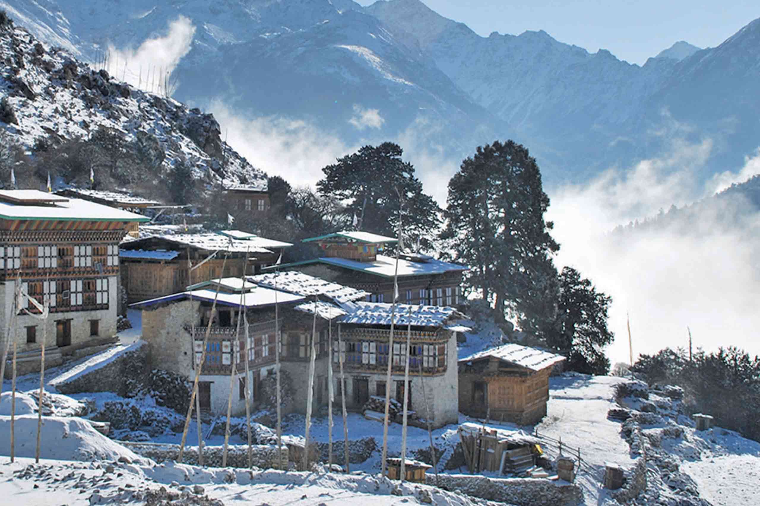
The trail gradually ascends to reach a Chorten (Stupa) below Lingshi Dzong. You have the choice of staying on the main trail or climbing up to the Lingshi Dzong (4220m), which sits right atop a high ridge. After Lingshi Dzong, it is an easy and pleasant walk through Lingshi villages and yak herders’ camps. On reaching the campsite at Chebisa, you will have enough time to visit the village houses. Additionally, there is a beautiful waterfall located behind the village.
Day 9 : Chebisa to Shomuthang
17Km | 6-7 hours | 570m Ascent | 290 Descent | Camp altitude 4130m
Today, the trail starts with a steep ascent behind Chebisa Village through a wide meadow towards Gobu La pass at an altitude of 4420m. While trekking, you will see a few people herding yaks and you may also see herds of blue sheep. After crossing Gobu La, you will descend into the valley, then climb again a little bit before descending again to Shakshepasa (3980m), a large U-shaped valley. Finally, climbing from here, you will reach the campsite at Shomuthang, above a river, which is a tributary of the Nochu river.
Day 10 : Shomuthang to Robluthang
15Km | 5-6 hours | 620m Ascent | 590 Descent | Camp altitude 4160m
You begin the trail climbing up the valley. Edelweiss grows everywhere along the trail. The snow peak you can see to the southeast is Kang Bum (6526m). After two hours of climbing, you will reach Jhari La (4750m), from where you catch the first glimpse of Sinche La, the pass you will have to cross the day after. The big snow peak in the north is Gangchhenta (Tiger Mountain), 6840m. The camp by the river is called Tsheri Jathang, located in a beautiful wide and remote valley. Climb up a little bit and you will reach the campsite at Robluthang in a rocky meadow.
Day 11 : Robluthang to Lingmithang
19Km | 7-8 hours | 850m Ascent | 870m Descent | Camp altitude 4140m
Expect a long climb to Shingela Pass (5,010m). Along the way, mountain views from the path are stunning. As you descend, you’ll see an impressive terminal moraine and a glacial lake at the valley floor. Below this moraine, cross the Kango Chhu and soon reach Lingmithang campsite. Notably, Gangchhenta Peak towers over camp even from a distance.
Day 12 : Lingmithang to Laya
10Km | 3-4 hours | 60m Ascent | 340 Descent | Camp altitude 3850m
Wake up to a superb view of Gangchhenta Peak directly in front of you. Today’s walk to Laya is pleasant with wonderful views. Along the route, you’ll pass through damp forest filled with moss and singing birds. Finally, arrive at Laya village, the country’s second-highest settlement at 3,850m. From the west, you’ll enjoy spectacular views of Mt. Gangchhenta and Mt. Masagang.
Day 13: Acclimatization day in Laya
Today is a rest day for acclimatization. Explore the village with a walk or go for a short hike above the camp to prepare for the next day’s trek.
Day 14: Laya to Rodophu
19Km | 6-7 hours | 900m Ascent | 70m Descent | Camp altitude 4160m
From Laya, descend to the Lunana trail junction and then climb to a hilltop with nice views over the Mo Chhu and the Rhodo Chhu. Following Rhodo Chhu valley, continue through rhododendrons and juniper bushes. You can get a good view of the glacial valley and a glacier on Tsenda Gang (7100m). The camp is just next to the Rhodu Chu.
Day 15: Rodophu to Narithang
17Km | 5-6 hours | 755m Ascent | 15m Descent | Camp altitude 4900m
Following the river for half an hour, the route steadily climbs to a high open valley at 4600m through rhododendron bushes. Then, you will climb further to the Tshomo La Pass (4915m), with views of Jomolhari and Jichu Drake, and good views of the Tibetan border. The route then crosses a flat, empty area at about 5000m. The campsite at Narethang is towered by the peak of Gangla Karchung (6,395m).
Day 16: Narithang to Tarina
18Km | 6-7 hours | 220m Ascent | 770m Descent | Camp altitude 4350m
Climbing for an hour, you reach Ganglakarchung Pass at an altitude of 5120m. The views of Kangbum (6530m), Tsendhen Gang (7100m), Teri Gang (7300m), and Jejegangphu Gang (7120m) are stunning from the pass. You will descend through massive moraines to the edge of a straight cliff with views of a glacier hanging from Teri Gang that forms two turquoise-colored lakes at the base. The lake towards the left in the 1960s caused a flood downstream in Punakha, destroying the Mochu Bridge. Descend through a steep path to the U-shaped valley following the Tangchu stream towards the right to arrive at your camp at 4350m.
Day 17: Tarina to Woche
15Km | 5-6 hours | 100m Ascent | Camp altitude 4450m
Moving through junipers and rhododendrons, the trail descends along the Tangchu River on the left, passing through amazing waterfalls. After a gentle climb out of the valley for some time, you will make a steep ascent to Woche Village, the first settlement in the Lunana region at an altitude of 4350m.
Day 18: Woche to Lhedi
19Km | 6-7 hours | 300m Ascent | 450m Descent | Camp altitude 4200m
Climbing up the Woche valley through juniper, fir, and rhododendron, cross a small stream to go over a moraine. You will then descend to a wooden bridge across Woche Chu River and climb up past a clear glacial lake to reach Keche La pass (4650m) with great views of nearby mountains including the three-prong peaks of Jejegangphu Gang mountain. Descending to Pochu Valley, you reach Thaga village at 4050m. In the late afternoons, one can expect bitterly cold winds at Thaga Village in autumn. From Thaga village, descend passing a few scattered settlements and waterfalls, and reach Lhedi (4200m) after walking along the Phochu River bed. Lhedi village has a school, Basic Health Unit, and a wireless station.
Day 19: Lhedi to Thanza
19Km | 5-6 hours | 250m Ascent | Camp altitude 4250m
The walk becomes quite easy today. We will follow the north bank of Phochu River, passing through several small farms, and then reach Chuzo Village (4090m) sometime around lunchtime. Along the way, visit the Chezo Dzong. We follow the trail along the riverbed and then climb a steep hill overlooking Thanza valley at 4250m.
Day 20: Rest day in Thanza
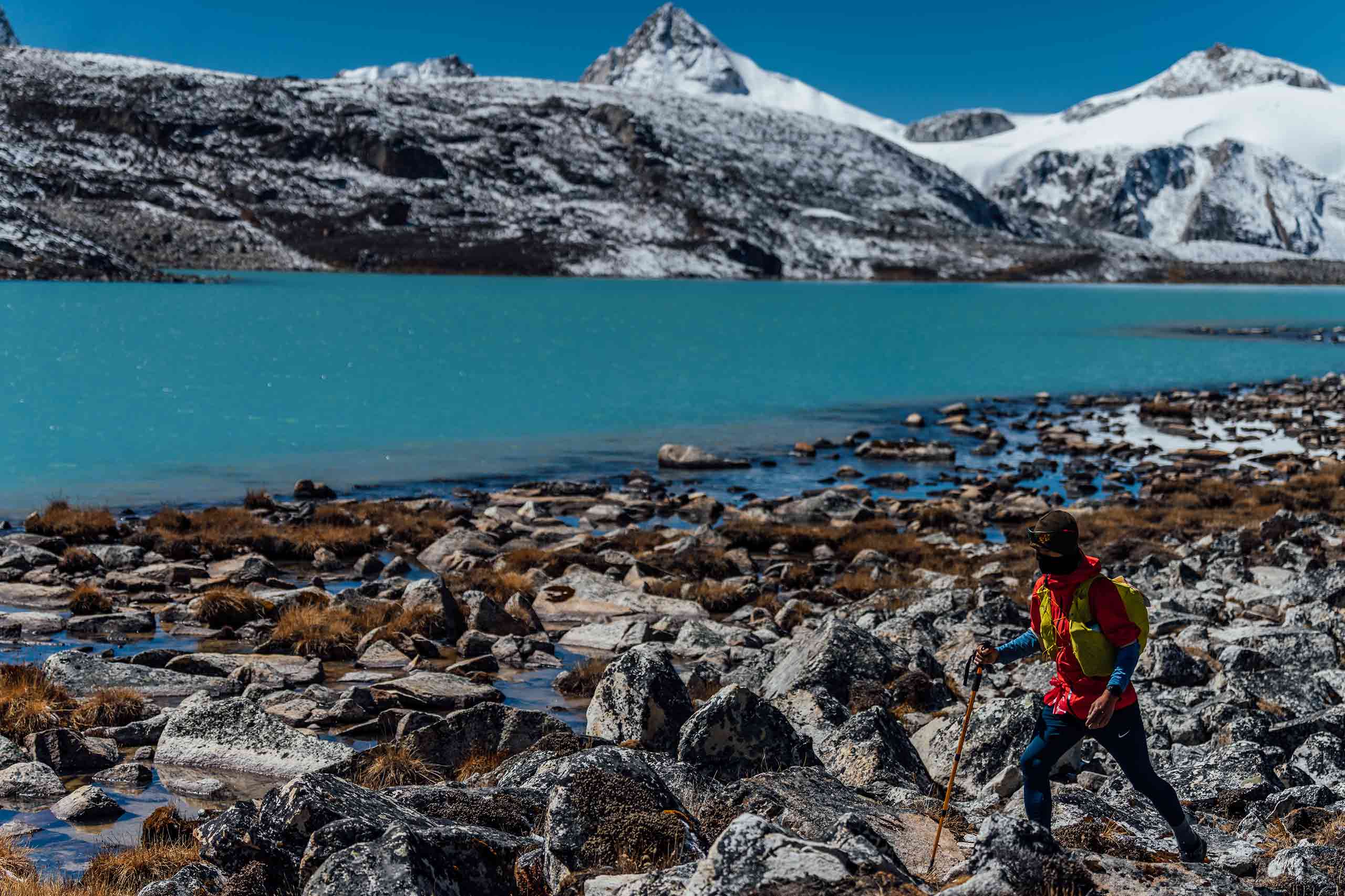
Today you will have a rest day at Thanza. Walk around Thanza village and nearby glacial lakes. Three hours of gradual hiking through small moraine rocks would lead you to clusters of beautiful views of Raphstreng Tsho and Thorthormi Tsho. The view of the 7100m Table Mountain is great because it forms a 3000m high wall of ice and snow behind Thanza Village.
Day 21: Thanza to Tshochena
18Km | 7-8 hours | 750m Ascent | Camp altitude 5000m
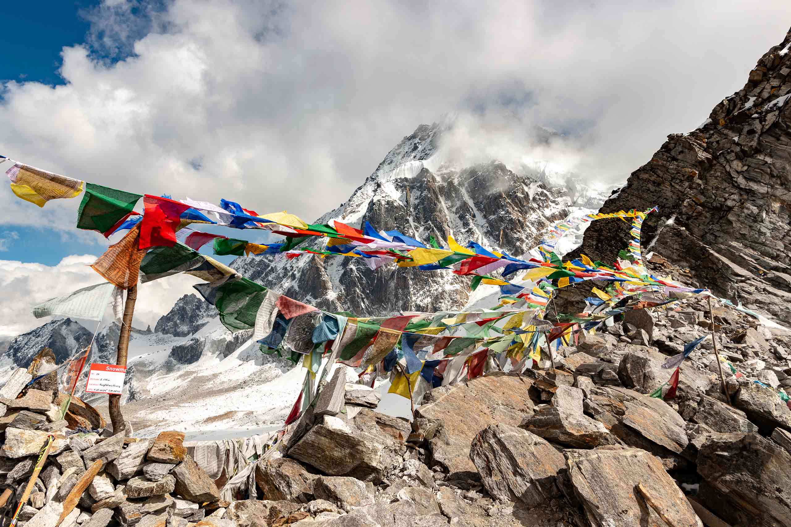
Climbing a ridge, the trail offers a great view of Table Mountain and Thanza valley below. After a few hours of easy walking, we reach Danji (4500m). At Danji, you may also see herds of blue sheep grazing on the meadows. From here, climb for some time to the top of the ridge, which offers good views of surrounding mountains. We take the trail to the right that leads to Jaze La pass. The Jazela pass, which is at 5200m, offers great views of surrounding mountains in all directions. From here, descending through snow-capped peaks and lakes, we reach Tshochena.
Day 22: Tshochena to Jichu Dramo
14Km | 5-6 hours | 170m Ascent | 120m Descent | Camp altitude 5050m
We follow the shore of a blue-green lake and then climb to a ridge at 5150m, which offers all-around views of snowy peaks. From here, the road and the microwave tower at Dochu La can also be viewed in the far distance. Going up and down over a small rounded hill, we then pass a glacial lake and reach Loju La pass (5170m), which is a yak pasture with many crisscrossing yak trails. We take a trail that crosses a small saddle-like hill at 5120m to a wide glacial valley. We descend further down to Jichudramo camp (5050m), which is the highest campsite on our entire trek.
Day 23: Jichu Dramo to Chukarpo
15Km | 5-6 hours | 300m Ascent | 950m Descent | Camp altitude 4400m
We will climb through a moraine path to the beautiful Rinchen Zoe pass (5350m), which divides Phochu and Mangdechu basins. The Gangkar Puensum (7520m), the highest mountain in Bhutan, can be seen from this pass. Furthermore, the line between the forests and the empty high-altitude areas can be clearly seen from here. Descending through a broad marshy valley with strings of lakes, a steep face of moraine, and yak pastures, we reach Tampe Chu, which is surrounded by rhododendron and juniper forests. We camp at Thongsa Thang (4400m) some distance away from Chukarpo.
Day 24: Chukarpo to Tampetsho
19Km | 7-8 hours | 80m Descent | Camp altitude 4320m
We descend following the right bank of a river to a Galapang yak pasture at 4025m. We will then climb steeply through forests of junipers and silver firs until we reach Tampetsho. Following a stream, the trail to Tampetsho leads to a beautiful clear turquoise-colored lake, which is set like a bowl surrounded by steep ridges. We will camp at the end of the lake at 4320m.
Day 25: Tampetsho to Maraothang
16Km | 4-5 hours | 280m Ascent | 980m Descent | Camp altitude 3620m
Today, we will climb steeply to the Tampela Pass (4600m). The sight of blue sheep on the mountain slopes above the trail is common here. We then descend to the Omtsho Lake. According to legend, in the 15th century, the famous saint Terton Pema Lingpa miraculously discovered a treasure from this lake. Going toward the shore of the lake, the trail reaches its outlet marked by prayers and then descends steeply past a waterfall to a small lake. Finally, the trail meets the left bank of Nika Chu River. After some time, we reach a large open area close to the meeting point of a major tributary flowing from the east. We will then cross a wooden bridge and walk along mixed forests to reach Maraothang (3620m), which is a wide open area with yak herder’s camps and your last night’s camp.
Day 26: Maraothang to Nika Chhu Zam (Trek ends)
20Km | 6-7 hours | 970m Descent | Camp altitude 2650m
The last day of the trek goes gradually downhill through mixed deciduous and bamboo forests. We further descend through forests and pastures connecting to a large grassy area overlooking the motor road and Sephu Village (2650m). Your car will be waiting here to transfer you to Punakha. Overnight hotel in Punakha.
Day 27: Punakha to Thimphu
In the morning, you will visit Punakha Dzong, the most beautiful Dzong in Bhutan, and Chimi Lhakhang, which is a fertility temple dedicated to the Divine Madman or Lama Drukpa Kuenley. You will then drive to Thimphu via Dochula pass. In the evening, you can stroll in Thimphu city. Overnight hotel in Thimphu.
Day 28: Thimphu to Paro Depart
In the morning, you will drive to the airport for departure. Our representative will bid you farewell.
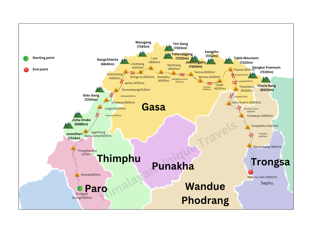
Trail Map
INCLUSION & eXCLUSION
INCLUSION
- Sustainable Development Fee (SDF)
- Accommodation
- All meals
- Transport
- All internal taxes & charges
- Licensed Bhutanese Tour Guide
- Equipment & haulage for trekking tour
EXCLUSION
- Airfare
- Insurance
- Drinks & beverages
- Phone/internet bills
- Tips
- Internet and Phone bills
- Other bills of personal nature
INSURANCE
The tour package does not include travel insurance of any kind. Guests are strongly advised to obtain comprehensive travel insurance coverage from their home country prior to the commencement of their trip. Such coverage should include, but not be limited to, medical expenses, trip cancellation, personal accidents, loss of baggage, and emergency evacuation.
Trekking in Bhutan
Whether you are looking for a day hike or a gruelling 31 day adventure, Bhutan has it all. Pristine mountain lakes, imposing glaciers and some of the world’s most endangered species await you in the mountainous amphitheatre of the Himalayas. Let us give you a selection of some of the country’s finest treks.