memories for a lifetime
Snowman Trek
Detail about the package
Tour Itinerary
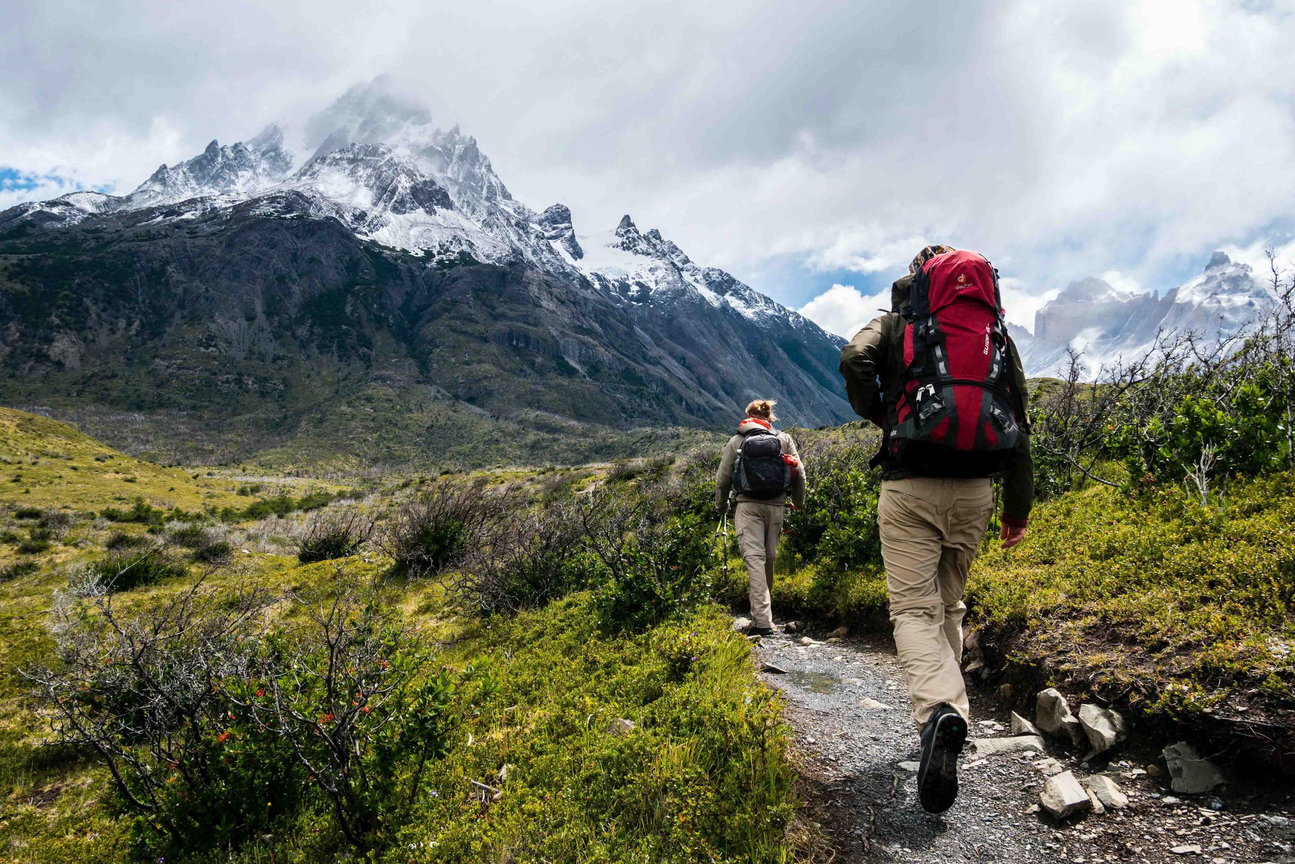
Snowman Trek, Bhutan’s most beautiful trekking route in the entire Himalayas.
Snowman Trek in Bhutan is one of the most beautiful treks in the whole Himalayas. Billed as the most difficult trek in the world due to altitude, duration and distance, far more people climb Mount Everest in Nepal than completing this alpine quest. The trek goes on northern Bhutan along the border with Tibet crossing thirteen Himalayan mountain passes some as high as 5000m. You will have spectacular views of Mt. Jumolhari, Jichu Drake, Masangang, Tiger Mountain and Gangkar Puensum and other conspicuous peaks along the northern border.
The fight to Paro crosses the Himalayan Mountains, affording spectacular views of the awesome peaks, including the sacred jumolhari and jichu Drake in Bhutan. On arrival in Paro Airport, you will be received by our guide and transfer to restaurant for lunch . After lunch, you will visit the Rinpung Dzong, the 15th century massive fortress which now serves as administrative and monastic center of the valley. From the Dzong, you can walk down to the road head crossing a traditional wooden bridge. After that you will be taken to Kichu Lhakhang, one of the oldest and the most sacred temple built in 7th century. In the evening, you can stroll in Paro town.
5Km | 4-5 hours | 900m Ascent
After breakfast, you will hike to Taktsang (Tiger’s Nest) Monastery, Bhutan’s most famous monastery, which is located at face of the cliff( 3100m) offering the best view of Paro valley. Today’s hike will be the acclimatization for the next day’s trek. According to the legend, it is believed that Guru Rimpoche, the 8th century Spiritual Master, flew to this location on the back of a tigress to meditate. Lunch will be served at Cafeteria Restaurant halfway up on the mountain. Explore the monastery and hike back to Paro. Overnight in hotel
17Km | 4-5 hours | 450 Ascent | 70Descent Camp| altitude 2850m
Drive 30 minutes North of Paro, where trek starts from Drugyal Dzong at 2400m with a downhill walk on a wide trail. The trail gradual ascents through Chentoe village of rice terraces and fields of millet and area of an Apple orchards. . After about four hours walk you will reach the army post at Gunitsawa (2,800m). At the army check point your trek permit (provided by your tour operator) will be checked and endorsed, then walk for another 20 minutes to reach our campsite. The campsite is on the opposite side of the Paro river.
21Km | 6-7 hours | 900 Ascent | Camp altitude 3750m
Today will be the long day trek, following Paro river crossing several time wooden bridges and Paro river. The trail enters National Park after crossing the wooden Bridge, continues with lots of small ups and downs in the forest of Dhododendrons,fir,hemlock,Larch,sprouse and Birch. After crossing the last bridge for the day, climb uphill gradually through the meadow where a camp will be set up at the altitude of 3750m. From here, if weather permits, you will see amazing view of Mt. Jumolhari.
19Km | 4-5 hours | 300 Ascent | Camp altitude 4050m
This morning see Jomolhari Peak, if you have not seen last night, the trek continues up through the forest for 40 minutes, then widens into patches of alpine meadow following the Paro river. Today you will cross above treeline(4000M) and cross an army checkpoint along the way and enjoy a spectacular view of high mountain ridges and snow-capped peaks. The trail becomes easier, in this area, where yaks, Yak- herder’s camp can be seen, passing through the villages will be another highlight on this trek. Before reaching to our campsite,,we will come across community school and basic health care center, this is the place where Jomolhari Festival is held, where Highlander comes to exchange their culture and tradition and products. From here you will catch the most beautiful view of Jichu Darke and Tsheringmagang peaks.. Then, the trail gradually ascents to reach the most beautiful campsite for the trek facing majestic Jomolhari peak, just nearby we can also see ruin fortress.
Today is rest day in Jangothang provides plenty of possibilities for day hikes with great views of lakes and snow capped mountains such as Jumolhari and Jichu Drake. There is the great opportunity to spot some blue sheep and Marmot on the upper slopes of the valley. Jangothang is a perfect environment for your acclimatization. You can also trek up to Tsophu Lake (Twin Lake) or hike towards Jomolhari Peak.
19Km | 6-7 hours | 800 Ascent | 730 Descent | Camp altitude 4100m
From the camp, walk on the valley for 20 minutes, then cross Paro river, the trail follows steep ascents for about one an half hour to 2 hours to reach the Nyele La Pass at an altitude of 4830m,if weather permits you can see scenic view of Jomolhari, Jichudarke and Tsheringmagang peaks. From the pass steep descents to the Lingshi camp, from here trail becomes easy through wide meadow from the ridge catch breathtaking view of the valley, Lingzhi Dzong.
12Km | 5-6 hours | 100m Ascent | 250m Descent | Camp altitude 3850m
The trail ascents gradual to reach a Chorten(Stupa) below Lingshi Dzong. You have the choice of staying on the main trail or climb up to the Lingshi Dzong (4220m), which sits right atop a high ridge. After Lingshi Dzong, It is an easy day and pleasant walk through Lingshi villages and yak herders camp. On reaching the campsite at Chebisa, you will have enough time to visit the village houses. There is beautiful waterfall located behind the village.
17Km | 6-7 hours | 570m Ascent | 290 Descent | Camp altitude 4130m
Today starts the trail steep ascent behind Chebisa Village through a wide meadow towards Gobu La pass at an altitude of 4420m. While treking, you will see a few people herding yaks and you may also see herds of blue sheep now . After crossing Gobu La, you will descend into the valley, then climb again a little bit, before descending again to Shakshepasa (3980m), a large U-shaped valley. Climbing from here you will finally reach the campsite at Shomuthang, above a river, which is a tributary of the Nochu river.
15Km | 5-6 hours | 620m Ascent | 590 Descent | Camp altitude 4160m
You begin the trail climbing up the valley. Edelweiss abounds along the trail. The snow peak you can see to the southeast is Kang Bum (6526m). After two hours of climbing you will reach Jhari La (4750m), from where you catch the first glimpse of Sinche La, the pass you will have to cross the day after. The big snow peak in the north is Gangchhenta (Tiger Mountain), 6840m. The camp by the river is called Tsheri Jathang located in a beautiful wide and remote valley. Climb up a little bit and you will reach the campsite at Robluthang in a rocky meadow.
19Km | 7-8 hours | 850m Ascent | 870m Descent | Camp altitude 4140m
It is a long climb to Shingela pass (5010m). The view of the mountains from the path is stunning. As you descend, you will see an impressive terminal moraine and a glacial lake at the foot of the valley. Below the moraine, you cross the Kango Chhu and soon reach the Lingmithang campsite. The peak of Gangchhenta towers over the campsite even though it’s quite a distance away.
10Km | 3-4 hours | 60m Ascent | 340 Descent | Camp altitude 3850m
In the morning you wake up with a superb view of Gangchhenta peak in front of you. The walk to Laya is very pleasant with wonderful views. You will pass through a damp forest, filled with moss and singing birds. Arrive at Laya village, the second highest settlement in the country, at altitude of 3850m. From the west of the village, you will have spectacular views of Mt. Gangchhenta and catch Mt. Masagang.
Today is the rest day and acclimatization. Explore walk through the village or go for short hike above the camp and prepare for the next day trek.
19Km | 6-7 hours | 900m Ascent | 70m Descent | Camp altitude 4160m
The trail leads descend to the Lunana trail junction and then ascent to hilltop with nice views over the Mo Chhu and the Rhodo Chhu. The trail continues following Rhodo Chhu valley, through rhododendrons and junipers bushes. You can get a good view of the glacial valley and a glacier on Tsenda Gang (7100m). The camp is just next to the Rhodu chu.
17Km | 5-6 hours | 755m Ascent | 15m Descent | Camp altitude 4900m
The trail follows the river for half an hour, then steady ascents to a high open valley at 4600m through rhododendron bushes, then you will climb further to the Tshomo La Pass (4915m), with the views of the Jomolhari and jichu Darke, and good scenic of Tibetan borders. The route then crosses a flat, barren plateau at about 5000m. The campsite at Narethang is towered by the peak of Gangla Karchung (6,395m).
18Km | 6-7 hours | 220m Ascent | 770m Descent | Camp altitude 4350m
The trail climbs an hour to Ganglakarchung Pass at an altitude of 5120m. The views of Kangbum (6530m), Tsendhen Gang (7100m), Teri Gang (7300m) and Jejegangphu Gang (7120m) are stunning from the pass. You will descend through massive moraines to the edge of straight cliff with views of glacial hanging from Teri Gang that forms two turquoise-colored lakes at the base. The lake towards the left in 1960s due to outburst has caused a flood downstream in Punakha destroying the Mochu Bridge. Descend through a steep path to the U-shaped valley following the Tangchu stream towards right to arrive at your camp at 4350m.
15Km | 5-6 hours | 100m Ascent | Camp altitude 4450m
The trail passes through the junipers and Rhododendron down the Tangchu River on the left passing through amazing waterfalls. After a gentle climb out of the valley for sometimes, you will climb steep ascent to Woche Village, the first settlement in Lunana region at an altitude of 4350m.
19Km | 6-7 hours | 300m Ascent | 450m Descent | Camp altitude 4200m
The trail ascents up the Woche valley through juniper, fir and Rhododendron and cross a small stream to go over a moraine. You will then descend to a wooden bridge across a Woche Chu River and climb up past a clear glacial lake to reach Keche La pass (4650m) with magnificent views of nearby mountains including three-prong peaks of Jejegangphu Gang mountain. The trail then descends to Pochu Valley and reaches Thaga village at 4050m. In the late afternoons, one can expect bitterly cold winds at Thaga Vilalge in autumn. From the Thaga village, we descend passing few scattered settlements, waterfalls and reach Lhedi (4200m) after walking along the Phochu River bed. Lhedi village consists of a school, Basic Health Unit and a wireless station.
19Km | 5-6 hours | 250m Ascent | Camp altitude 4250m
The walk becomes quite easy today. We will follow the north bank of Phochu River passing through several small farms and then reach Chuzo Village (4090m) sometime around the lunchtime. En route visit the Chezo Dzong. We follow the trail along the riverbed and then climb a steep hill overlooking Thanza valley at 4250m.
Today you will have a rest day at Thanza. Walk around Thanza village and nearby glacial lakes. Three hours of gradual hike through small moraine rocks would lead you to clusters of fascinating views of Raphstreng Tsho and Thorthormi Tsho. The view of 7100m Table Mountain is superb because it forms 3000m high wall of ice and snow behind Thanza Village.
18Km | 7-8 hours | 750m Ascent | Camp altitude 5000m
The trail starts climbing a ridge with a great view of Table Mountain and Thanza valley below and after few hours of easy walk, we reach Danji (4500m). At Danji, you may also see herds of blue sheep grazing on the meadows. From here, climb for sometimes the top of the ridge, which offers good views of surrounding mountains. We take the trail to the right that leads to Jaze La pass. The Jazela pass, which is at 5200m, offers manificient views of surrounding mountains in all directions. From here, the trail descends through snow-capped peaks and lakes to Tshochena.
14Km | 5-6 hours | 170m Ascent | 120m Descent | Camp altitude 5050m
We follow the shore of a blue-green lake and then climb to a ridge at 5150m, which offers panoramic views of snowy peaks in 360-degree. From here, the road and the microwave tower at Dochu La can also be viewed in far distance. The trail goes up and down over a small rounded hill. We then pass a glacial lake and reach Loju La pass (5170m), which is a yak pasture with many crisscrossing yak trails. We take a trail that crosses a small saddle-like hill at 5120m to a wide glacial valley. We descend further down to Jichudramo camp (5050m) – this is the highest campsite on our entire trek.
15Km | 5-6 hours | 300m Ascent | 950m Descent | Camp altitude 4400m
We will climb through a moraine path to the picturesque Rinchen Zoe pass (5350m), which divides Phochu and Mangdechu basins. The Gangkar Puensum (7520m), the highest mountain in Bhutan can be seen from this pass. Further, the demarcation between the forests and the barren high altitude areas are remarkably seen from here. Descending through a broad marshy valley with strings of lakes, steep face of moraine and yak pastures, we reach Tampe Chu, which is amidst rhododendron and Juniper forests. We camp at Thongsa Thang (4400m) some distance away from Chukarpo.
19Km | 7-8 hours | 80m Descent | Camp altitude 4320m
We descend following the right bank of a river to a Galapang yak pasture at 4025m. We will then climb steeply through forests of junipers and silver firs until we reach Tampetsho. The trail to Tampetsho follows a stream to a beautiful clear turquoise-colored lake, which is set like in a bowl surrounded by steep ridges. We will camp at end of the lake at 4320m.
16Km | 4-5 hours | 280m Ascent | 980m Descent | Camp altitude 3620m
Today, we will climb steeply to the Tampela Pass (4600m). The sight of blue sheep on the mountain slopes above trail is common here. We then descend to the Omtsho Lake. The legend has it that, in 15the century, the famous saint Terton Pema Lingpa miraculously discovered a treasure from this lake. The trail goes toward the shore of the lake and reaches it’s outlet marked by the prayers and then descends steeply pass a waterfall to a small lake. The trail finally meets the left bank of Nika Chu River. After sometime, we reach to a large open area close to the confluence a major tributary flowing from east. We will then cross a wooden bridge and walk along mixed forests to reach Maraothang (3620m), which is a wide open area with yak herder’s camp and your last night camp.
20Km | 6-7 hours | 970m Descent | Camp altitude 2650m
The last day of the trek goes gradually downhill through mixed deciduous and bamboo forests. We further descend through forests and pastures connecting to large grassy area overlooking the motor road and Sephu Village (2650m). Your car will be waiting here to transfer you to Punakha. Overnight hotel in Punakha.
In the morning, you will visit Punakha Dzong, the most beautiful Dzong in Bhutan and Chimi Lhakhang, which is a fertility temple dedicated to the Devine Madman or Lama Drukpa Kuenley. You will then drive to Thimphu via Dochula pass. Evening, you can stroll in Thimphu city. Overnight hotel in Thimphu.
In the morning, you will drive to the airport for departure. Our representative will bid you farewell.
Other Details
Inclusion & Exclusion
- Government levy/taxes & visa fee
- Transport by private vehicle
- Government approved 3-star hotels
- English speaking guide
- Permits, entrance fees, & sightseeing
- Sleeping tents, sleeping mats & pillows
- Dinning tents, kitchen tent & toilet tent
- Tables, chairs, utensils, hot water bags
- Trekking chef & assistants
- Horses to carry trek equipments
- Food supplies
- Airfare
- Insurance
- Laundry
- Drinks & beverages
- Phone/internet bills
- Tips
- Wire transfer charge/card fee
- Sleeping bag
- Other bills of personal nature
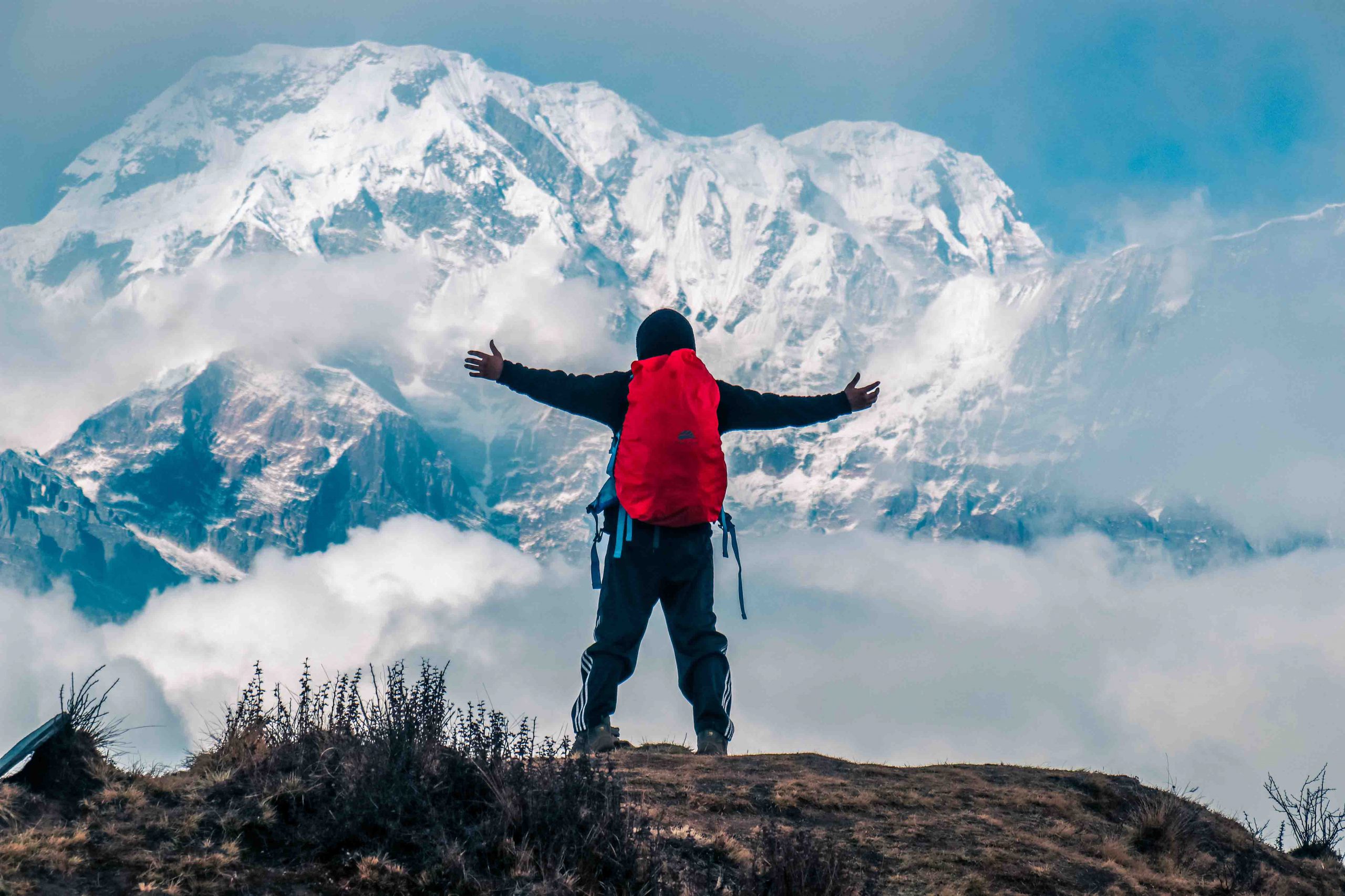
Trekking in Bhutan
Whether you are looking for a day hike or a gruelling 31 day adventure, Bhutan has it all. Pristine mountain lakes, imposing glaciers and some of the world’s most endangered species await you in the mountainous amphitheatre of the Himalayas. Let us give you a selection of some of the country’s finest treks.